Maps of Cumberland 1580 to 1794
1580 – 1665 Cumberland West March of England Maps
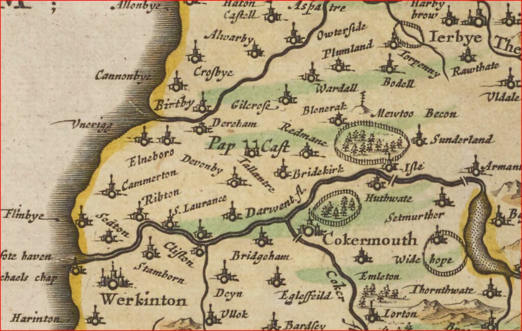
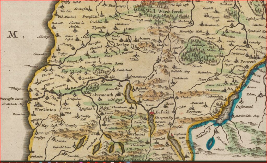
Based on notes and sketches 1580-1613 by Timothy Pont who travelled in Scotland and northern England. Although robbed and suffering in primitive conditions, his notes, updated by Gordon of Straloch, were the basis of the first maps of Scotland created by Blaeu in the Netherlands who made an atlas which included maps based on his notes and sketches, some of which are amusing – for example see the “pict holes” of Moresby in this translation of text on the reverse of the map
“… We think that the Romans had some fortifications here because it was the last limits of the Empire that the Irish and Scottish reached. The little village of Moresby seems to have been one of their havens: effectively we can find many remains, amongst other things, underground vaults, which the inhabitants named picts holes, the caverns of Pictes, there are some inscriptions, one of which has “Lucium Severinum Ordinatum, the other COH, VII and an alter with a horned animal enscribed ……”
See http://reivers.info/cumberland-west-march-england-cumberland-maps-1580-1665/ and National Library of Scotland online (links from reivers.info). This set of information explains Dovenby Hall pele tower in its historical and location context, see introduction of why a defensive pele tower was built at http://reivers.info/pele-tower/ and other information at http://reivers.info/
The map sections are from 1600 Cumberland Map Sellofeld to Inglewood Forest Pont Blaeu note that the spelling is phonetic – spell it as it sounds. The letter “f” is the letter “s” in the script of 1600 though in other maps it seems to be used as “f” or even “l”.
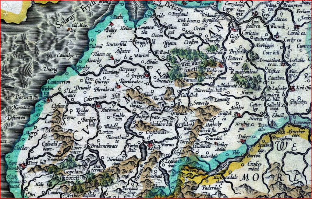
1595 Cumberland Map by Mercator and Hondius
Map of Northumberland, Cumberland and Durham county, showing towns, villages, parks and castles, rivers and hills, but not roads. The Roman Wall is shown. County boundaries, parks and hills coloured. Descriptive text on reverse in Latin.
This map shows the location of ‘Deuonby’ (Dovenby).
From G. Mercator and J. Hondius, Atlas or a geographicke description… of the world (Amsterdam, H. Hondius & J. Jansson, 1595).
AUTHOR: Mercator, Gerhard, 1512-1594 OTHER AUTHOR: Hondius, Jodocus, 1563-1612 PLACE PUBLISHED: [Amsterdam] DATE PUBLISHED: [1595]
The links below allow you to zoom in to see great detail, please use them. The mouse scroll wheel zooms; icons on the web page zoom and pan.
http://valentine.dur.ac.uk/pip/place1.asp?page=1&place1=%25northumberland%25&placephrase=
1611 Cumberland map by Speed and Hondius
Cumberland and the ancient citie Carlile described with many memorable antiquities therein found observed
A fine first edition of this iconic map of Cumberland with a detailed inset map of Carlisle. Notable antiquities have been included pictorially and explained. A ship and a huge sea monster have been depicted in the sea. Shields for the three earls of Carlisle included to right. Title in a circular cartouche, flanked by a lion and unicorn, below a crowned heraldic shield.
John Speed (1552-1629) is the most famous of all English cartographers primarily as a result of The Theatre of the Empire of Great Britaine, the first atlas of the British Isles. The maps from this atlas are the best known and most sought-after of all county maps. The maps were derived mainly from the earlier prototypes of Christopher Saxton and John Norden but with notable improvements including parish “Hundreds” and county boundaries, town plans and embellishments such as the coats of arms of local Earls, Dukes, and the Royal Household. The maps are famed for their borders consisting of local inhabitants in national costume and panoramic vignette views of major cities and towns. An added feature is that regular atlas copies have English text printed on the reverse, giving a charming description of life in the early seventeenth century of the region. The overall effect produced very decorative, attractive and informative maps.
For the publication of his prestigious atlas, Speed turned to the most successful London print-sellers of the day, John Sudbury and George Humble. William Camden introduced the leading Flemish engraver, Jodocus Hondius Sr. to John Speed in 1607 because first choice engraver William Rogers had died a few years earlier. Work commenced with the printed proofs being sent back and forth between London and Amsterdam for correction and was finally sent to London in 1611 for publication. The work was an immediate success, with the maps themselves being printed for the next 150 years.
Speed was born in 1552 at Farndon, Cheshire. Like his father before him he was a tailor by trade, but around 1582 he moved to London. During his spare time Speed pursued his interests of history and cartography and in 1595 his first map of Canaan was published in the “Biblical Times”. This raised his profile and he soon came to the attention of poet and dramatist Sir Fulke Greville a prominent figure in the court of Queen Elizabeth. Greville as Treasurer of the Royal Navy gave Speed an appointment in the Customs Service giving him a steady income and time to pursue cartography. Through his work he became a member of such learned societies as the Society of Antiquaries and associated with the likes of William Camden, Robert Cotton, and William Lambarde. He died in 1629 at the age of seventy-seven.
[This map is available as a jigsaw which Christine and I found at the Cockermouth Hospice shop. The text above is from a sales website for the original map for £800]
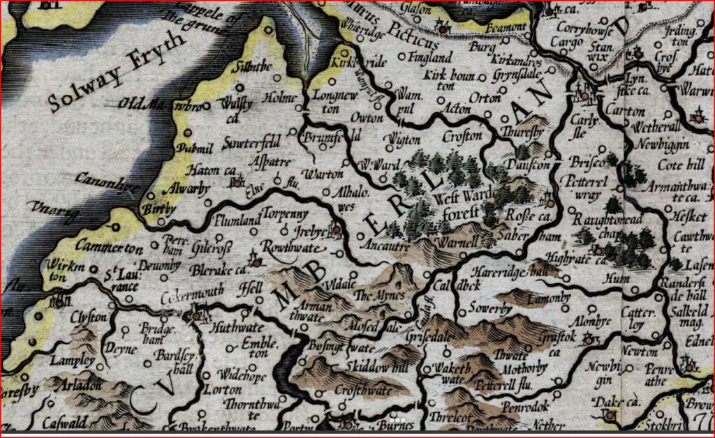
1636 Cumberland Map by Mercator and Hondius
Contents description: map of Northumberland, Cumberland and Durham county, showing towns, villages, parks and castles, rivers and hills, but not roads. The Roman Wall is shown. County boundaries, parks and hills coloured. Title in a cartouche… Descriptive text on verso in English. Bar scale unit described on map as ‘Milliaria mediocriae Anglicae’.
From G. Mercator and J. Hondius, Atlas or a geographicke description… of the world (Amsterdam, H. Hondius & J. Jansson, 1636). Reprint of Mercator’s map first published in 1595, with new cartouche and scale, Mercator’s signature deleted, and sea shading removed.
Northumbria, Cumberlandia, et Dunelmensis episcopatus. By G. Mercator, Gerhard, 1512-1594 Hondius, Jodocus, 1563-1612; Amsterdam Published 1636
The links below allow you to zoom in to see great detail, please use them. The mouse scroll wheel zooms; icons on the web page zoom and pan.
http://valentine.dur.ac.uk/pip/place1.asp?page=1&place1=%25northumberland%25&placephrase=
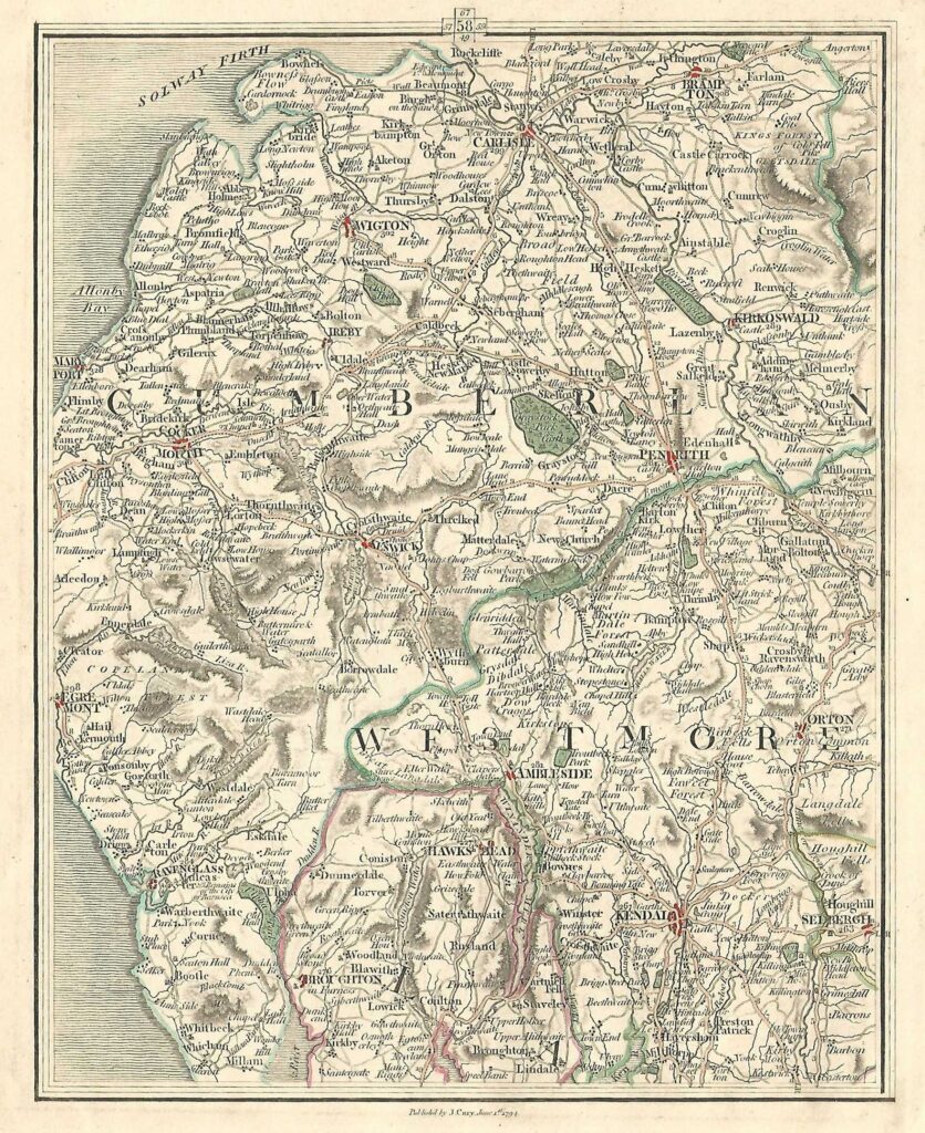
1794 Cumberland by Cary and Hutchinson
This map shows the location of Dovenby Hall, adjacent to a road between Maryport and Cockermouth
John Cary (c. 1754 – 1835) was an English cartographer. Cary served his apprenticeship as an engraver in London, before setting up his own business in the Strand in 1783. He soon gained a reputation for his maps and globes, his atlas, The New and Correct English Atlas published in 1787, becoming a standard reference work in England. In 1794 Cary was commissioned by the Postmaster General to survey England’s roads. This resulted in Cary’s New Itinerary (1798), a map of all the major roads in England and Wales. He also produced Ordnance Survey maps prior to 1805. In his later life he collaborated on geological maps with the geologist William Smith. His business was eventually taken over by G. F. Cruchley (1822–1875).
Cumberland is a historic county of North West England that had an administrative function from the 12th century until 1974. It was bordered by Northumberland to the east, County Durham to the southeast, Westmorland and Lancashire to the south, and the Scottish counties of Dumfriesshire and Roxburghshire to the north. It formed an administrative county from 1889 to 1974 (excluding Carlisle from 1914) and now forms part of Cumbria.
Westmorland formerly also spelt Westmoreland; even older spellings are Westmerland and Westmereland is a historic county in north west England. It formed an administrative county between 1889 and 1974, after which the whole county was administered by the new administrative county of Cumbria.
https://www.mapsandantiqueprints.com/shop/antique-maps/cumbria-westmorland-antique-map/#.YxNwAnbMKUl
Images from Hutchinson’s History of the County of Cumberland Vol II 1794
William Hutchinson (1732–1814) was an English lawyer, antiquary and topographer. His two-volume History of Cumberland was published in 1794.
Cumbria County History Trust: Your Online Resource for the History of Cumbria: see https://www.cumbriacountyhistory.org.uk/ This site contains more than 7000 pages. he Cumbria County History Trust (CCHT) was set up in May 2010 with the aim of producing a permanent, detailed record of the history of Cumbria, as part of the Victoria County History project, founded in 1899, which aims to write the definitive history of every place in every county in England. Learn more about VCH Cumbria here.
